The geography of Santa Clara-a-Nova: the land beneath the village
Santa Clara-a-Nova lies on the west side of the municipality of Almodôvar, Beja district, in the Baixo Alentejo region of Portugal. The village sits on a ridge, on the step between the Alentejo plain to the north and the Serra do Caldeirão hills to the south. This page, and the film that goes with it, tell why the village is where it is: before the houses, the land had already chosen the place.
In short
- Santa Clara-a-Nova sits on a broad ridge, on the step between the Alentejo plain to the north and the Serra do Caldeirão to the south, on the west side of the Almodôvar municipality.
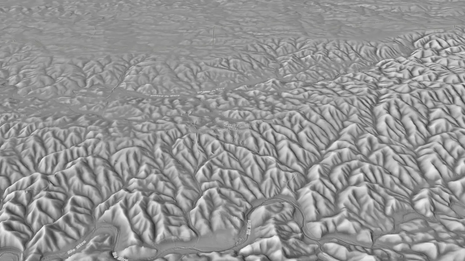
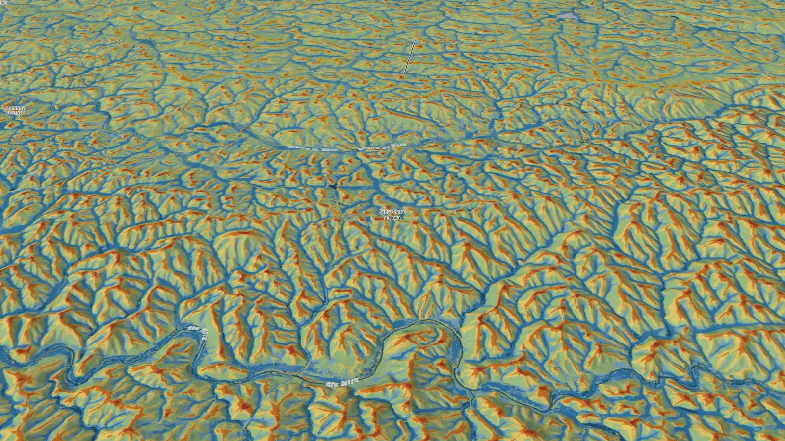
- The terrain model shows the village on the line that splits two waters: rain on the south side goes to the Rio Mira, rain on the north side to the Ribeira de Mora.
- The Rio Mira rises inside the parish itself, on the north slope of the Serra do Caldeirão, 12.5 km south of the village, and reaches the Atlantic at Vila Nova de Milfontes.
- Every ravine has two faces: one turned north, cooler, and one turned south, where the sun beats all day.
- Around the houses lies a small island of almost flat land, the vegetable plots and yards, with one foot in the hills and the other on the plain.
The film
The land beneath, in 4 minutes
Seen from above
Portugal, Almodôvar, Santa Clara-a-Nova
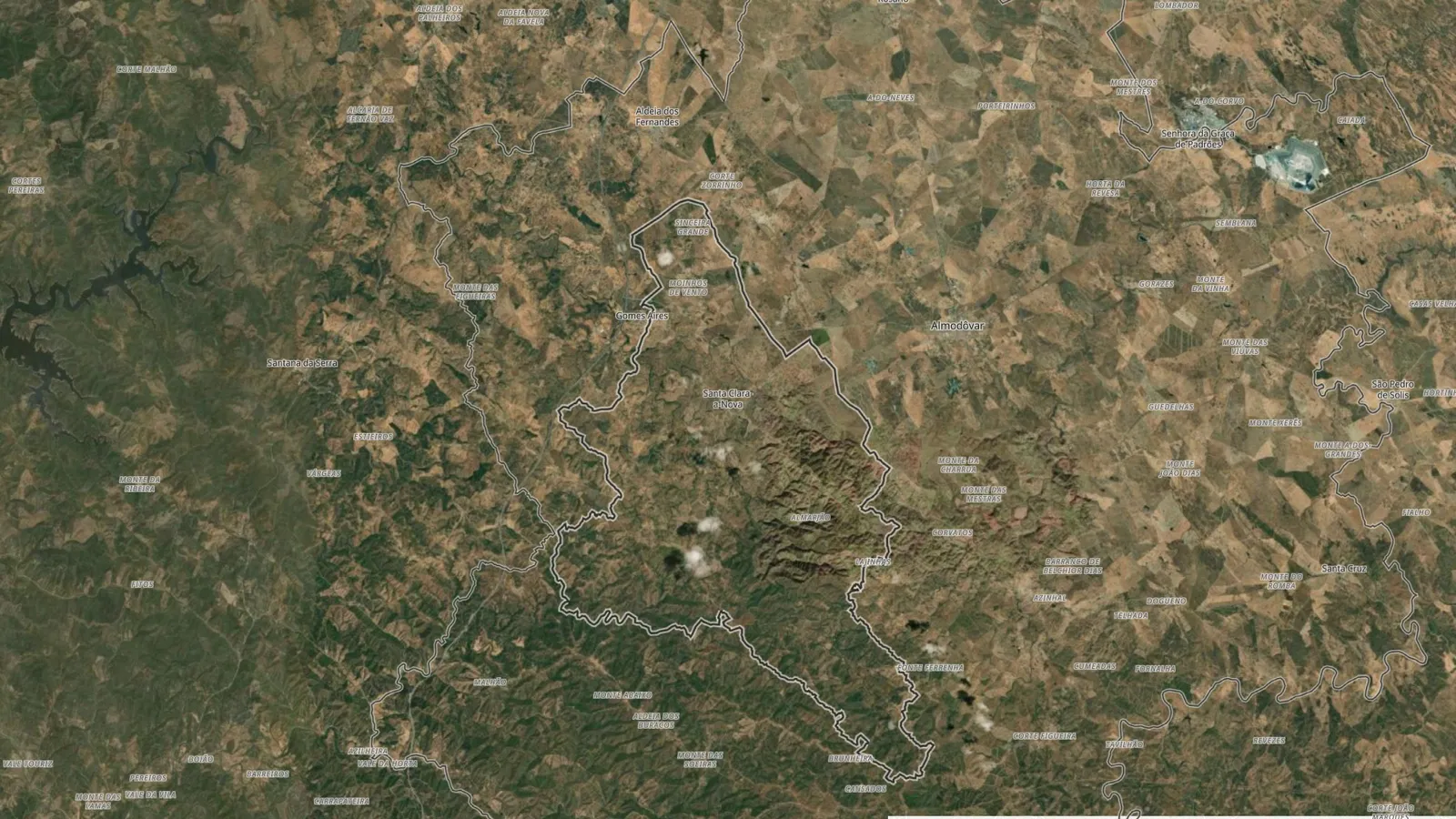
Santa Clara-a-Nova lies on the west side of the Almodôvar municipality, where the Alentejo plain begins to fold into the hills. The land here is not all the same height, and the village sits right on the step between the two halves.
Portugal, seen from above. Down there, to the south, where the Alentejo plain begins to fold into the hills, there is a municipality: Almodôvar. And on the west side of Almodôvar, where the land begins to wrinkle, there is a village resting on a ridge. Santa Clara-a-Nova.
To the north, the land slopes gently down to the plain, low and wide. To the south, it rises, fold after fold, up to the Serra do Caldeirão. Santa Clara-a-Nova sits right on the step between the two.
From up here it looks simple: white houses, vegetable plots, a road, scattered cork oaks. But the village is not where it is by chance. The land chose the place first.
Dressed and bare
Take away the trees and the houses
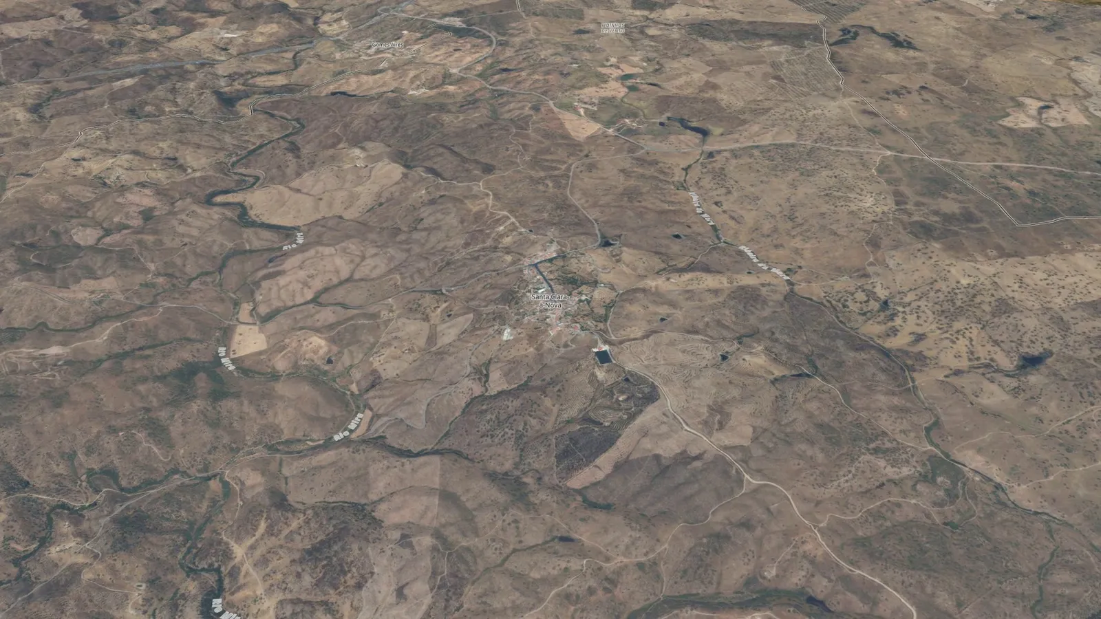
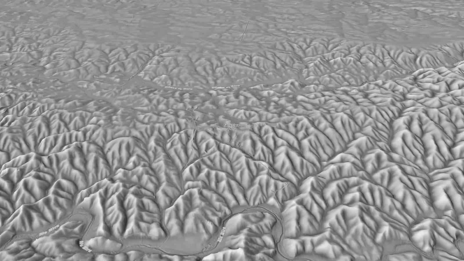
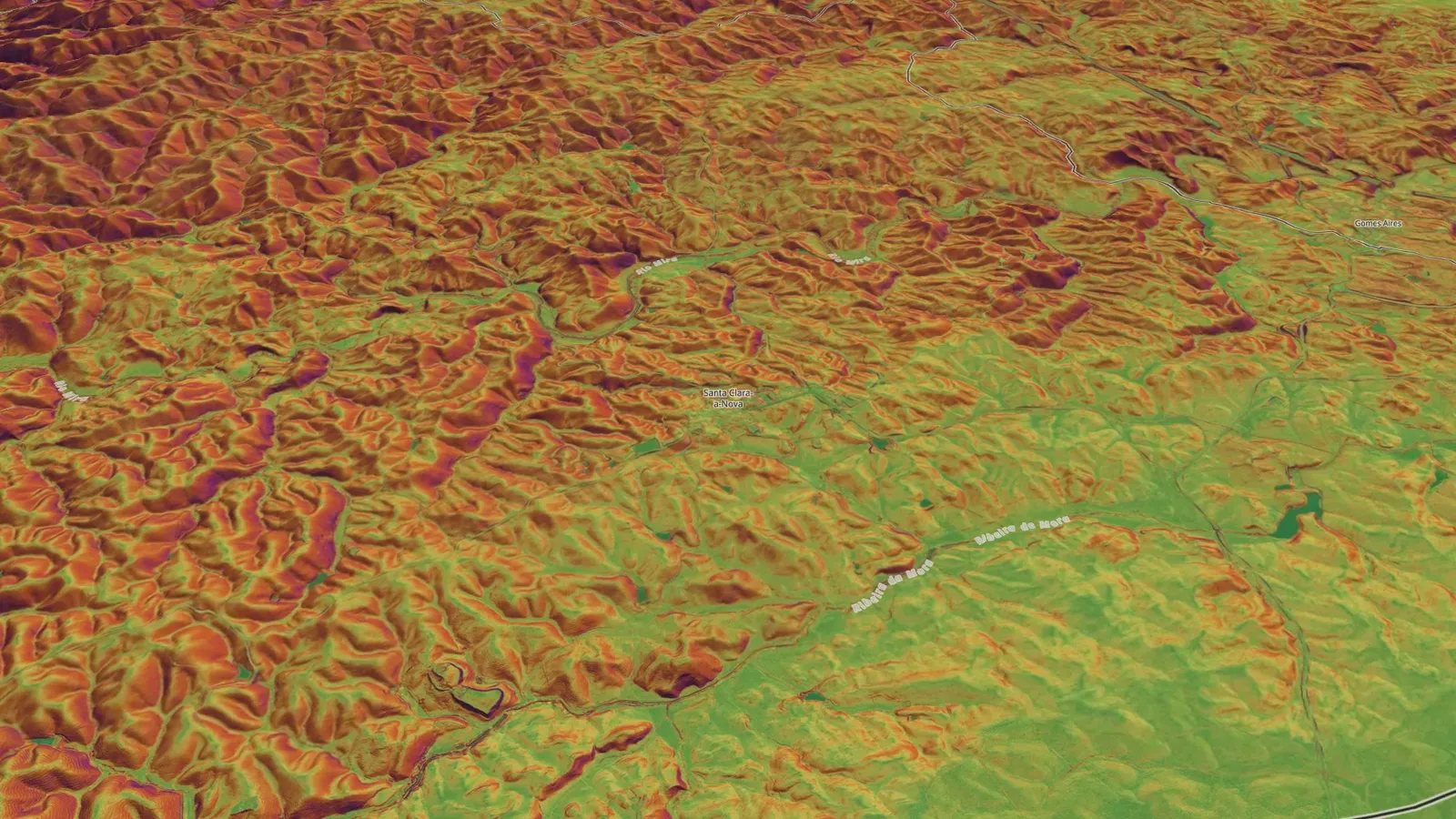
Without trees or houses, the ground of Santa Clara-a-Nova is made of thousands of small valleys. That skin of the land, not what stands on it, explains where the village is.
Let us first look at the land with everything on it. Every tree, every house, every wall. This is how we know it: dressed.
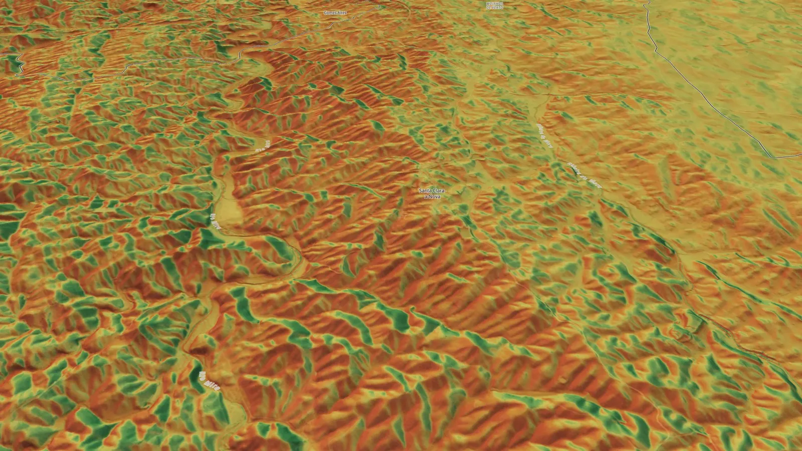
Now let us take it all away. The trees, the houses, the roads. Only the skin of the land is left. And the skin of the land, here, is all wrinkles. Thousands of small valleys, cut by water into the schist, drop by drop, for longer than memory reaches.
Two hands
Ridges and valleys
Around Santa Clara-a-Nova, the ridges and the valleys fit into each other like two interlaced hands. The village sits on one of the few broad, flat backs that this network left.
Seen like this, the ridges and the valleys fit into each other like two interlaced hands. Where the land rises, where the land falls.
And if we step back, the hands multiply: a whole network, ridge after ridge, valley after valley, as far as the eye can see. The village sits on one of the few broad, flat backs the schist left behind.
The rain and the river
The line that splits two waters
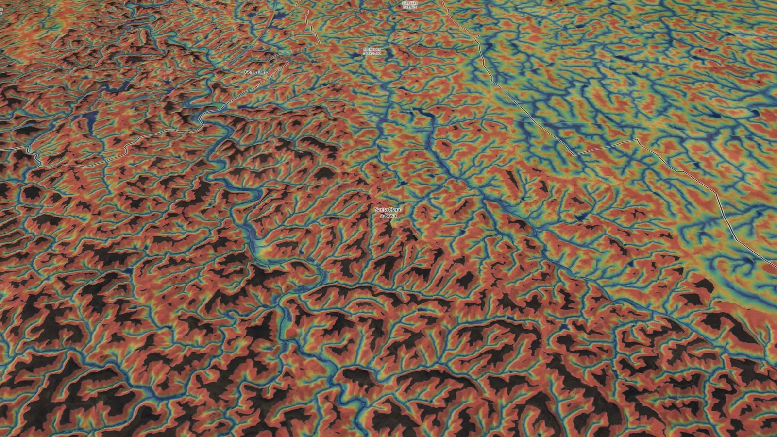
The terrain model shows Santa Clara-a-Nova on the line that splits two waters: rain falling on the south side goes to the Rio Mira, rain on the north side follows the Ribeira de Mora. And the Mira rises in the parish itself, 12.5 km south of the village.
Everything that happens here begins with the rain. Each drop looks for the nearest valley; the threads join, and become streams.
The terrain model shows the village on top of the line that splits two waters. Rain falling on the south side goes to the Mira. Rain on the north side follows the Ribeira de Mora, which further west also ends in the Mira.
And the Mira rises here, in these hills: in the parish of Santa Clara-a-Nova, on the north slope of the Serra do Caldeirão, about 2 km north of the Pico do Mú and 12.5 km south of the village. From here it will be a river all the way to the sea, at Vila Nova de Milfontes, 130 to 145 km later depending on the source.
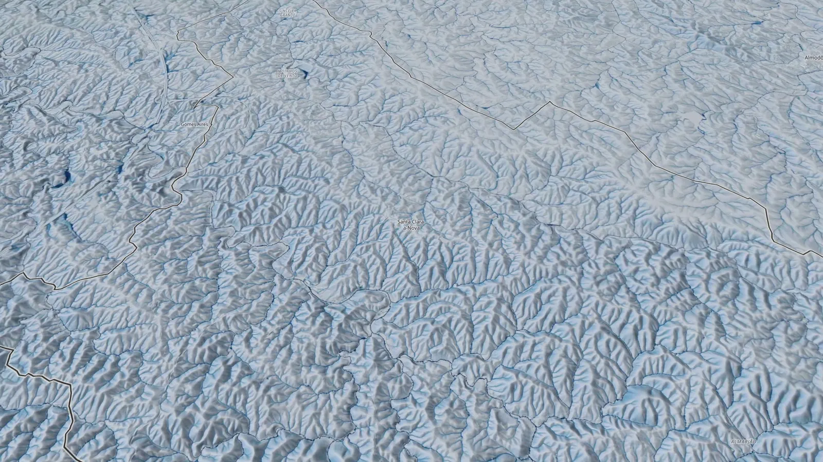
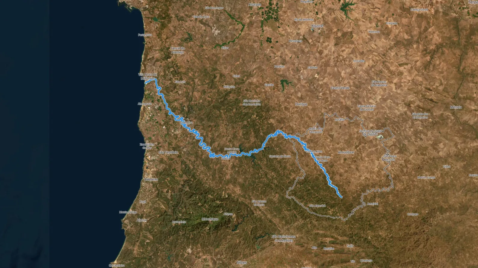
The parish priest already wrote it in 1758, and the official maps confirm it: where the Rio Mira rises
Water, sun and wind
Clear of the flood, always in sight of it
Santa Clara-a-Nova stayed on high ground, clear of the water that floods in winter but always in sight of it. Around it, every ravine has a cool face and a sunny face, and the cut-up land gives shelter from the wind.
Not all the land is the same distance from the water. At the bottom of the valleys, water runs every winter. On the ridges, up above, the land stays dry and safe. The village stayed on top: clear of the water that floods, but always in sight of it.
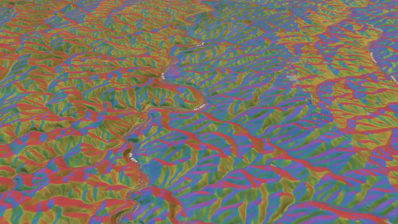
In land this broken, every ravine has two faces. One turned north, cooler, where the trees last through the summer. The other turned south, where the sun beats all day and only the gum rockrose holds out. Those who lived here always knew which side to plant.
The film shows the shelter the land gives from the north-west wind. The ridges take it head on; the valleys and the slopes facing the morning sun stay sheltered. Every hundred metres, the land offers a new shelter.
The island
One foot in the hills, the other on the plain
Santa Clara-a-Nova is where it is because around the houses lies an island of almost flat land, the age-old vegetable plots and yards. To the west and south the land drops in steep slopes; to the east opens the grain plateau.
That is why the village is where it is. Around the houses lies an island of almost flat land: the vegetable plots and yards of always.
To the west and south, the land falls away in steep slopes, where only scrub and cork-oak woodland fit. To the east opens the grain plateau. Santa Clara-a-Nova sits on the border between the two worlds, with one foot in the hills and the other on the plain.
Up close, you can see what the land let grow on top of it: the low houses, the yards, the cork oaks and holm oaks, each with its own height, each in its place. Beneath the houses, the land is still the same: the wrinkles, the water, the sun and the wind. It was the land that chose the place. People only had to recognise it.
2 km from the village, on the same border between hills and plain, lies an Iron Age settlement: the Mesas do Castelinho
Fact sheet: the land of Santa Clara-a-Nova
- Where
- West side of the Almodôvar municipality, Beja district, Baixo Alentejo, PortugalSource: Official parish boundaries, Direção-Geral do Território
- Position of the village
- On a ridge, on the step between the plain (north and east) and the Serra do Caldeirão (south and west)Source: Terrain model, shown in the film
- Where the rain goes
- South side: Rio Mira. North side: Ribeira de Mora, which later joins the Mira to the westSource: Reading of the terrain model, shown in the film
- Source of the Rio Mira
- In the parish, north slope of the Serra do Caldeirão, about 2 km north of the Pico do Mú and 12.5 km south of the villageSource: Rio Mira page (1758 Parish Memoir and official hydrography)
- Mouth of the Rio Mira
- The Atlantic, at Vila Nova de Milfontes, 130 to 145 km from the source depending on the sourceSource: Rio Mira page
- Shelter from the wind
- Exposed ridges; sheltered valleys and east-facing slopes. The film takes the north-west as the wind directionSource: Reading of the terrain model, no local measurement
- Mesas do Castelinho
- About 2 km from the village, on the same border between hills and plainSource: Mesas do Castelinho page
Questions
Is Santa Clara-a-Nova in the hills or on the plain?
Both. Santa Clara-a-Nova, in the Almodôvar municipality, sits on a ridge on the step between the Alentejo plain, which stretches north and east, and the Serra do Caldeirão, which rises to the south and west. The village has one foot in the hills and the other on the plain.
Where does the rain that falls on the village go?
The terrain model shows the village on the line that splits two waters: rain falling on the south side goes to the Rio Mira, rain on the north side follows the Ribeira de Mora, which further west also flows into the Mira.
Where does the Mira River rise?
In the parish of Santa Clara-a-Nova, Almodôvar municipality, on the north slope of the Serra do Caldeirão, about 2 km north of the Pico do Mú and 12.5 km south of the village. It reaches the Atlantic at Vila Nova de Milfontes. The Rio Mira page brings together the 1758 document and the official maps.
Why is the village on a ridge?
Because that is the place the land offers: on high ground, clear of the water that floods the valleys in winter but always in sight of it, on one of the few broad, flat backs in the area. Around the houses lies an island of almost flat land, the plots and yards, ringed by steep slopes.
What does the film "A terra por baixo" show?
It is a 4-minute film, narrated in Portuguese. It starts from the whole of Portugal, comes down to Almodôvar and Santa Clara-a-Nova, takes away the trees and houses and shows the ground: the ridges and valleys, the paths of the rain, the Rio Mira to the sea, the sunny and shady slopes, the shelter from the wind and the island of flat land where the village settled.
Where is Santa Clara-a-Nova?
In the municipality of Almodôvar, Beja district, in the Baixo Alentejo region of Portugal, on the west side of the municipality. The village is about 15 km from Almodôvar and about 70 km from Beja, between the Campos de Ourique plain and the Serra do Caldeirão.
How it was made
What is fact and what is a reading
The terrain model is built from the public information of the Direção-Geral do Território (Portugal's national mapping agency) and the 2025 aerial photographs. The film takes the trees and houses away and shows the ground in ten views, each with a question: where it rises, where the water runs, where the sun falls, where the wind is kept off.
The ground
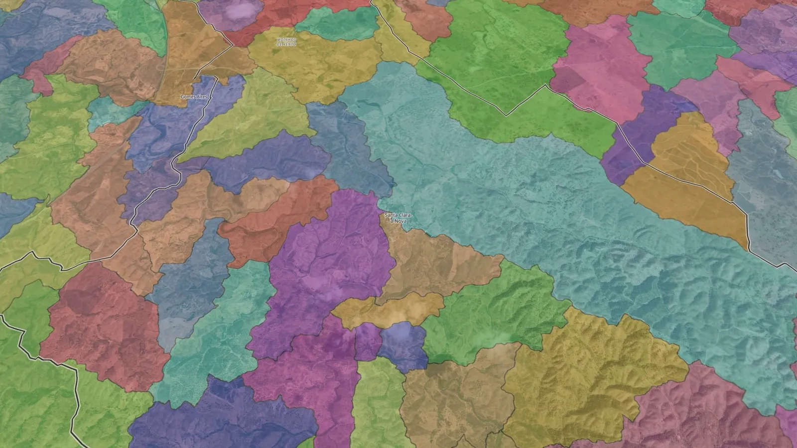
The terrain model shows the shape of the ground with nothing on it. The 2025 aerial photographs show the land dressed. The municipality and parish boundaries are the official ones.
What is fact
Where the village lies, where the Rio Mira rises and where it meets the sea are documented and checked on the Rio Mira page. We reuse those figures without recomputing them.
What is a reading
The line that splits two waters and the shelter from the wind are readings of the terrain model, not measurements on site. The film takes the north-west as the wind direction; we do not yet have a measurement from the village that confirms it.
What we left out
We do not give the village's altitude: the sources we found disagree, and we would rather not print a wrong number. Nor do we state the exact rock beneath the houses.
See also
The Village
Santa Clara-a-Nova in brief: where it is, the cork-oak landscape, the population and the parish that came back in 2025.
Meet the villageThe Rio Mira rises here
The priest wrote it in 1758 and the official maps confirm it: the source of the Mira lies in the parish, 12.5 km south of the village.
Read about the MiraMesas do Castelinho
The walled Iron Age settlement, 2 km from the village, on the same border between plain and hills.
Visit the MesasBoavista Windmill
The parish viewpoint, where the wind has always worked: the Ourique plain on one side, the Serra do Caldeirão on the other.
Climb to the windmillVisit
How to get to Santa Clara-a-Nova and what to see in the village and the parish.
Plan your visitSources and credits
The film and this page use public information. Links open in a new window.
- Direção-Geral do Território, 50 cm terrain model of mainland Portugal and 2025 aerial photographs
- Direção-Geral do Território, official municipality and parish boundaries, 2025 edition
- Esri World Imagery (Maxar, Earthstar Geographics), satellite imagery
- OpenStreetMap, course of the Rio Mira (way 407393803)
- Parish Memoir of Santa Clara-a-Nova, 1758, and the check of the Mira's source: see the Rio Mira page
Terrain model from LiDAR data by the Direção-Geral do Território (CC BY 4.0). Orthophotos 2025 © DGT. Satellite imagery © Esri, Maxar, Earthstar Geographics. Administrative boundaries from CAOP. Course of the Rio Mira © OpenStreetMap contributors (ODbL).