Boavista Windmill
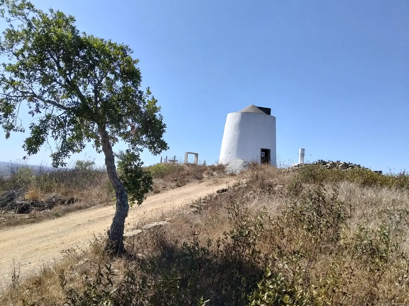
A whitewashed windmill on the Boavista summit, 453 metres above sea level, with the Alentejo plain opening to the north and the Serra do Caldeirão to the south. One of the highest points of the parish and one of its finest viewpoints.
The windmill
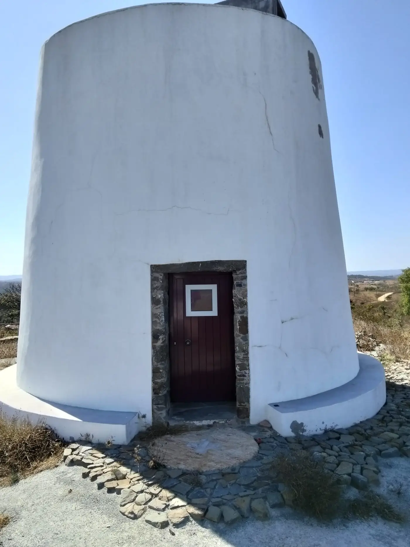
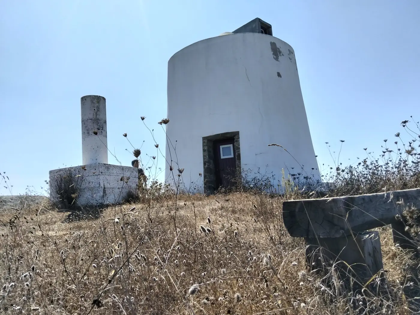
The Boavista Windmill is a tower windmill of the traditional Alentejo type: a whitewashed truncated-conical tower with door and windows framed in schist. Local tradition dates its construction to 1840. Today it stands restored, without sails, under a small conical cap; an old millstone serves as the doorstep, and other millstones mark the viewpoint.
On the same summit stands a pillar of the national geodetic network: the "Boavista" survey point, which for decades was materialised on the windmill's own cap. Thanks to it, the altitude here is known precisely: about 453 metres.
The official place name is Boavista, one word: a small hilltop settlement of the Santa Clara-a-Nova parish that lives up to its name ("good view").
At a glance
| Type | Tower windmill, restored |
| Built | 19th century (local tradition says 1840) |
| Altitude | 453 m ("Boavista" geodetic marker) |
| Distance from the village | ~5 km straight line; 6-8 km by track |
| Distance from Almodôvar | ~18 km by road |
| GPS coordinates | 37.44801 N, 8.17325 W |
| Entry | Free (outside); the interior is not open to visitors |
The view from the top
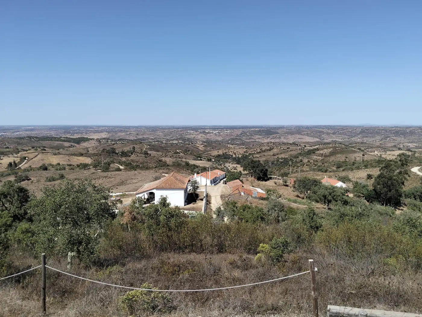
The summit is isolated and the view runs free all around. To the north and east opens the rolling plain of the Ourique countryside, dotted with whitewashed farmsteads and cork oaks. To the south and west rise the foothills of the Serra do Caldeirão.
On the horizon to the southeast is Pico do Mú (577 m), the highest point of the Almodôvar municipality, about 12 km away. To the southwest, some 40 km off, the Monchique hills with the Fóia. And on the clearest days, they say, the view reaches Beja to the north.
Getting there
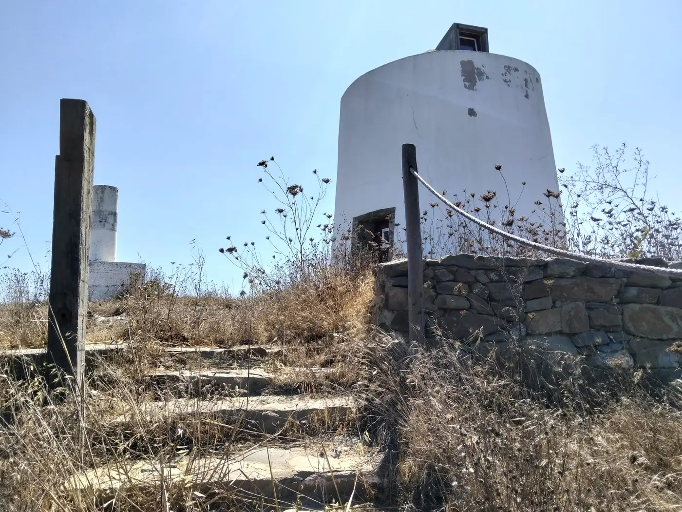
From the village of Santa Clara-a-Nova, take the EM 504 and turn onto the CM 1196 heading southwest; the last few kilometres follow unpaved rural tracks, passable with care. At the top, stone steps with a rope handrail lead up to the mill, with wooden benches and dry-stone walls framing the viewpoint.
Tips
- •A normal car makes it with care in dry weather; by mountain bike or on foot it is a beautiful outing
- •There is no shade at the top: avoid the hottest hours in summer
- •Late afternoon is best for the light and the cool
- •Bring water; there are no facilities of any kind
Gallery
Nearby
About 1.5 km to the east lies the Anta da Boavista, an inventoried megalithic monument ("Monte Abaixo / Anta da Boavista" site). On the way back to the village, the picnic park by the stream makes a good stop.
Picnic Park