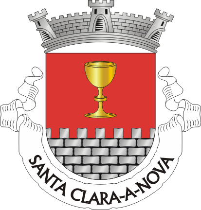
The Rio Mira rises in Santa Clara-a-Nova
The Rio Mira rises in the parish of Santa Clara-a-Nova, Almodôvar municipality, on the north slope of the Serra do Caldeirão, about 2 km north of the Pico do Mú and 12.5 km south of the village. The parish priest, Miguel Guerreiro Bogalho, wrote exactly that in May 1758, and the hydrography and parish boundaries of the Direção-Geral do Território confirm it today. No modern text we could find names the parish: they all stop at "Almodôvar municipality, Serra do Caldeirão". This page brings together the 1758 document, the official data and the method we used to check every point.
In short
- The Mira is 130 to 145 km long depending on the source, flows south to north (like the Sado) and reaches the Atlantic at Vila Nova de Milfontes.
- Its source lies in the parish of Santa Clara-a-Nova at 425-470 m, on the north slope of the Serra do Caldeirão, about 2 km from the Pico do Mú (577 m, already in the parish of São Barnabé).
- In 1758 the priest wrote: "Desta e dentro desta freguezia nasce a ribeyra de Odmira; em o sitio do Carvalhete e Saltao" (from and within this parish rises the Odemira stream, at the place of Carvalhete and Saltão). Both names survive: Carvalhete is a geodetic vertex and a windmill beside the upper Mira; Saltão is a locality in postcode 7700-240.
- The official "Rio Mira" line of the Direção-Geral do Território starts at 37.3889 N, 8.0797 W, inside the parish under the CAOP 2025 boundaries. OpenStreetMap puts the headwater 340 m from that point.
- Alto Mira is our name for the upper river, from the source to the Santa Clara reservoir: the whole parish lies within it. The dam, at Santa Clara-a-Velha (Odemira), stores the water born here and supplies the Neves-Corvo mine.
- Video: the priest's answer and today's maps in under two minutes, narrated in Portuguese, just below.
Watch the story of the Mira
What the priest wrote in 1758 and what today's maps show, in under two minutes
The course: from one Santa Clara to the other
From the source to the sea, in five stops
Source, Santa Clara-a-Nova
North slope of the Serra do Caldeirão, 425 to 470 m, 2 km north of the Pico do Mú. A dry gully most of the year: "you will find no water here unless it is raining", warns the geocache "Nascente do Rio Mira" (2012).
Carvalhete and the village
The river runs down past the Carvalhete geodetic vertex and its windmill, crosses the parish and passes near the village, where it receives the Ribeira de Mora, coming from Mesas do Castelinho.
Santa Clara dam
At Santa Clara-a-Velha, Odemira municipality: completed in 1968, inaugurated in 1969, a 1,986 ha reservoir. From here the water goes to the Neves-Corvo mine, back to the Almodôvar municipality.
Odemira
Where the "stream" becomes a river, said the priest, and where the tide reaches up to the Torrinha estate.
Vila Nova de Milfontes
The mouth, on the Atlantic, 130 to 145 km after the source. The Mira is one of the few Portuguese rivers that flow from south to north.
What the parish priest wrote in 1758
Parish Memoir of Santa Clara-a-Nova, 5 May 1758
“Desta e dentro desta freguezia nasce a ribeyra de Odmira; em o sitio do Carvalhete e Saltao, cujo nome tem por pasar a villa de Odmira, donde ja tem o nome de rio; mas com o mesmo nome entrando ahi ja a agoa da mare por ella asima athe a erdade da Torrinha sita na freguezia de Sancta Maria da villa de Odmira, e dahi se vai sepultar ao mar a Villa Nova de Mil Fontes, que fica ao poente, em o qual rio se nao admirao propriedades algumas notaveis.”
Miguel Guerreiro Bogalho, parish priest, "Sancta Clara sinco de Mayo de 1758". National Archive of Torre do Tombo, Memórias Paroquiais, vol. 11, no. 333, pp. 2291-2298 (PT/TT/MPRQ/11/333). Transcription by Lígia Duarte, "Portugal 1758" project, CIDEHUS, University of Évora. In English: "From and within this parish rises the stream of Odemira, at the place of Carvalhete and Saltão, which takes its name from passing the town of Odemira, where it already bears the name of river; the tide enters it there and goes up as far as the Torrinha estate, in the parish of Santa Maria of Odemira, and from there it goes to bury itself in the sea at Vila Nova de Milfontes, which lies to the west; and in this river no notable properties are admired."
After the earthquake of 1755 the Crown sent every parish priest in the kingdom a questionnaire about his parish. The answers are the Parish Memoirs of 1758, kept at the Torre do Tombo. The one for Santa Clara-a-Nova was signed on 5 May 1758 by the priest Miguel Guerreiro Bogalho, a chaplain presented by the King and a professed friar of the Order of Santiago.
In the chapter on the mountains, asked which rivers rise there, the priest answers plainly: the "stream of Odemira" rises within his parish, at the place of Carvalhete and Saltão; it is called a river from Odemira onwards, feels the tide as far as the Torrinha estate, and dies in the sea at Vila Nova de Milfontes. It is the same geography today's maps draw, written 267 years earlier.
The same document says the parish had "no memorable antiquity" (item 22), 2 km from the settlement of Mesas do Castelinho, which would only be recognised in 1987. And that the church chapel, damaged by the 1755 earthquake, was still unrepaired in 1758.
The parish in 1758, according to the priest
- Households
- 230, "scattered across various farms"
- People
- 640 adults and 200 children
- Settlement
- Only the "small village called da Igreja"; no other hamlet
- Church
- Five altars: Santa Clara, Santo António, São João Baptista, Our Lady of the Rosary, Holy Souls; two brotherhoods
- Priest
- Chaplain presented by the King, friar of the Order of Santiago, paid in wheat and barley
- Earthquake
- Church chapel with "some ruin" since 1755, "still unrepaired" in 1758
- Antiquities
- "It has no privilege, nor any memorable antiquity"
- Post
- None; it used Almodôvar's, "at the distance of one league"
Where the Mira rises: four spatial sources
Official and open data, queried in October 2026
The question "in which parish does the river rise?" is answered by two facts: where the river line begins and where the parish boundary runs. We used the state's hydrography and administrative boundaries, and OpenStreetMap as an independent cross-check.
Distances are straight-line (haversine) from the coordinates given. Around the headwater only unnamed intermittent streams exist; the official line carries the name "Rio Mira" within 1 km of the headwater and again beside the village, where it also names the Ribeira de Mora, which joins it.
Carvalhete and Saltão: the priest's place names survive
Two toponyms from 1758 on today's maps and postcode list
Carvalhete exists and sits on the upper Mira, inside the parish. It is a vertex of the National Geodetic Network (VG-DT73, 3rd order, 508.5 m, at 37.40539 N, 8.11244 W), 1.45 km from the river and 5.6 river-km below the headwater. Beside it are the Moinho do Carvalhete, a windmill 2.4 river-km below the headwater, and Monte Carvalhete, a house on road CM 1198-2, postcode 7700-240, which the official boundaries place in Santa Clara-a-Nova. The parish postcode list also has Carvalhote, Carvalhotinho and Carvalhosa, one vowel from the priest's spelling.
Saltão is a locality of the parish today: it appears in the list for postcode 7700-240 Santa Clara-a-Nova (ninth of seventy localities). It is not in OpenStreetMap and we could not pin it down; the postal site gives only the parish centre for every locality.
So "em o sitio do Carvalhete e Saltao" is exactly what the map says. Carvalhete is the named high ground beside the first kilometres of the Mira.
The Alto Mira
The upper valley of the river, where the whole parish lies
We call the upper stretch of the river the Alto Mira: from the source in the Serra do Caldeirão to the reservoir of the Santa Clara dam. It is not an official toponym; it is the descriptive name this site uses for the upper Mira basin, the way one says Alto Alentejo or Alto Minho. The parish of Santa Clara-a-Nova lies entirely within it.
The river has crossed the parish since 1874, at least in print: Pinho Leal wrote in Portugal Antigo e Moderno that "through the middle of the parish runs the Mira stream, and to the north the Ribeira Mór". Portaria no. 640-F3/94, which created the Santa Clara-a-Nova tourist hunting zone (1,332 ha), published in the official gazette a map labelled "RIO MIRA" through the zone south-west of the village. And the village, says the freguesias.pt entry, is "on the right bank of a stream, a tributary of the Rio Mira".
The Alto Mira landscape is one of transition: the cork-oak montado of the Ourique plain to the north, the strawberry-tree and rockrose hills to the south, and between them a valley the river cuts from south to north. It is the same range the 1758 priest described as "thirty-three leagues" long, "most frigid" in winter and "exceedingly hot" in summer.
The two Santa Claras are the two ends of one river
Santa Clara-a-Nova (Almodôvar) and Santa Clara-a-Velha (Odemira)
Everyone confuses the two. Santa Clara-a-Velha, in the Odemira municipality, gives its name to the dam and the reservoir. Santa Clara-a-Nova, in the Almodôvar municipality, gives the river its source. The Mira connects them: the water born here is the water the dam stores there.
And it comes back. The Neves-Corvo mine, next to Almodôvar, "receives its water from the Santa Clara dam". Water from the Alto Mira runs down to Santa Clara-a-Velha, is held back, and returns by pipeline to the municipality where it was born, to wash the copper and zinc this land lives on.
How we checked
Sources, data and what we corrected along the way
This page comes from an investigation carried out on 23 and 24 October 2026. Every claim was read at the original source or computed on official data; nothing rests on a third-party summary. Once written, the first version was reviewed source by source in a second, independent reading, without access to the conclusions, and corrected where it failed. The review log is in the investigation file.
1. The 1758 document
Transcription from the "Portugal 1758" project (CIDEHUS, University of Évora), downloaded and compared line by line with the live page: 58 lines, zero differences. Reference confirmed in the Torre do Tombo record (PT/TT/MPRQ/11/333), which corrects the transcription's "vol. 181" to vol. 11.
2. The river line
Query to the official "Linhas de água (EPIC)" layer of the Direção-Geral do Território (infogeo ArcGIS service), filtered by the name "Rio Mira": 122 segments. The upstream end is the southernmost dangling end of the hierarchy-1 line.
3. The parish of the point
Point-in-polygon on the official CAOP 2025 and CAOP 2022 boundaries (DGT), confirmed by geoapi.pt and by the parish polygon in OpenStreetMap (relation 6431883). Three independent routes, one result.
4. Open cross-check
Full geometry of the OpenStreetMap "Rio Mira" way (838 nodes) from the API; the first node is also the southernmost. Straight-line distances by the haversine formula.
5. The place names
Carvalhete: a National Geodetic Network vertex, a windmill and a house in OpenStreetMap, with the parish confirmed on the official boundaries. Saltão: the complete list of 70 localities in postcode 7700-240, read page by page.
6. The secondary sources
Pinho Leal (1874) read in the OCR of the Getty Research Institute copy on the Internet Archive; the 1994 Portaria viewed in the scanned gazette PDF; Wikipedia read in its wikitext via the API; Infopédia, freguesias.pt, the geocache and the municipal climate plan opened directly.
7. The negative claim
"No modern text names the parish as the source": tested with searches in several phrasings, on the municipality's site and in the Wikipedia articles on the parish and São Barnabé. Every mention stops at the municipality or the mountain range. Not checked: the APA RH6 river-basin plan and the parish council's site, neither indexed.
What the review corrected
- The signed date reads "Sancta Clara sinco de Mayo de 1758", not "Sancta Clara a Nova, 5 de Mayo de 1758" as the first version had it.
- A quotation about the mountain climate had an extra word; it was restored letter by letter: "nimiamente [sic] calida".
- The village-to-source distance was "about 12.3 km"; recomputed: 12.8 km to the OpenStreetMap node, 12.5 km to the end of the official line.
What we do not know
- Which of several intermittent gullies is "the" source is a cartographer's choice. The official line and OpenStreetMap agree to within 340 m; the geocache points to the same spot, at 470 m.
- Altitude varies by source: 470 m in most texts, 442 m at the OpenStreetMap node, 425 m at the end of the official line. So does length: 130 km (Portuguese Wikipedia), 145 km (English Wikipedia, Infopédia, geocache).
- Saltão is confirmed as a locality but not located on the map.
- In 1758 "freguesia" meant the ecclesiastical parish; its boundary then is undocumented. "Rises in the parish" is a statement about today's administrative boundary.
- The Pico do Mú is in São Barnabé. Saying the Mira "rises at the Pico do Mú" is loosely right: the named line begins 2 km north, across the parish boundary.
Rio Mira fact sheet
- Source
- Parish of Santa Clara-a-Nova, Almodôvar municipality, Beja district, Portugal; north slope of the Serra do Caldeirão
- Coordinates
- 37.3889 N, 8.0797 W (end of the official line); 37.3869 N, 8.0769 W (OpenStreetMap)
- Source altitude
- 425 to 470 m, depending on the source
- Distances
- 2 km north of the Pico do Mú (577 m); 12.5 km south of the village of Santa Clara-a-Nova
- Length
- 130 to 145 km, depending on the source
- Direction
- South to north, one of the few in Portugal (like the Sado)
- Basin
- About 1,540 to 1,800 km², depending on the source
- Dam
- Santa Clara, at Santa Clara-a-Velha (Odemira): completed 1968, inaugurated 1969, 1,986 ha reservoir
- Mouth
- Atlantic Ocean, at Vila Nova de Milfontes (Odemira)
- First mention of the source in the parish
- Parish Memoir, 5 May 1758, priest Miguel Guerreiro Bogalho
- Video
- O Rio Mira Nasce em Santa Clara-a-Nova: Escrito em 1758 (The Rio Mira Rises in Santa Clara-a-Nova: Written in 1758), 1 min 39 s, narrated in Portuguese, on the village's YouTube channel @santa-clara-a-nova (October 2026)
Frequently asked questions
Where does the Rio Mira rise?
In the parish of Santa Clara-a-Nova, Almodôvar municipality, Beja district, Portugal, on the north slope of the Serra do Caldeirão, about 2 km north of the Pico do Mú, between 425 and 470 m above sea level. The official "Rio Mira" line of the Direção-Geral do Território starts at 37.3889 N, 8.0797 W, inside the parish boundary.
In which parish does the Mira River rise?
Santa Clara-a-Nova. Published texts only say "Almodôvar municipality" or "Serra do Caldeirão", but the official parish boundaries (CAOP 2025) place the river's upstream end inside Santa Clara-a-Nova, and the parish priest had already written so in 1758.
What is the Alto Mira?
The upper stretch of the Rio Mira, from the source in the Serra do Caldeirão to the reservoir of the Santa Clara dam. It is not an official toponym: it is the descriptive name this site uses for the upper Mira basin. The parish of Santa Clara-a-Nova lies entirely within it, and the river runs through its middle.
How long is the Rio Mira?
Between 130 and 145 km, depending on the source: Portuguese Wikipedia says 130 km; English Wikipedia, Infopédia and the geocache at the source say 145 km. It flows from south to north and reaches the Atlantic at Vila Nova de Milfontes.
What does the 1758 document say?
"Desta e dentro desta freguezia nasce a ribeyra de Odmira; em o sitio do Carvalhete e Saltao": from and within this parish rises the stream of Odemira, at the place of Carvalhete and Saltão. It is the Parish Memoir of Santa Clara-a-Nova, signed by the priest Miguel Guerreiro Bogalho on 5 May 1758, kept at the Torre do Tombo (vol. 11, no. 333) and transcribed by CIDEHUS at the University of Évora. The video on this page, narrated in Portuguese, tells that answer in under two minutes.
What links Santa Clara-a-Nova and Santa Clara-a-Velha?
The Rio Mira. It rises in Santa Clara-a-Nova (Almodôvar) and is dammed at Santa Clara-a-Velha (Odemira), at the Santa Clara dam. They are two different villages at the two ends of the upper Mira, and the water stored at the dam supplies the Neves-Corvo mine, back in the Almodôvar municipality.
Can you visit the source of the Rio Mira?
The spot is about 12.5 km south of the village, reached by dirt tracks in the hills, with no signed trail. A geocache, "Nascente do Rio Mira", has led there since 2012; its own text warns that the gully only has water when it rains. The Boavista Windmill, in the parish, is the easiest viewpoint over the hills where the river rises.
Why does nobody say the Mira rises in Santa Clara-a-Nova?
Because published descriptions stop at the municipality or the mountain range. The priest said it in 1758, Pinho Leal wrote in 1874 that the river runs "through the middle of the parish", and the official data confirm it. We found no modern text that says it, so we checked it ourselves, source by source.
Keep exploring
The land beneath
Where the rain that falls on Santa Clara-a-Nova goes: the south side to the Mira, the north side to the Ribeira de Mora. The village's geography, in a 4-minute film.
See the land beneathBoavista Windmill
The parish viewpoint at 453 m: the Ourique plain, the Serra do Caldeirão and the Pico do Mú, above the source of the Mira.
Climb to the windmillSaint Clare of Assisi
The patron saint who names both Santa Claras on the river, and the church the 1758 priest described with five altars.
Meet the patron saintThe Miners
The Neves-Corvo mine, which drinks the Mira's water stored at the Santa Clara dam.
Read about the mineSources
All sources were opened in October 2026. Quotations are verbatim; coordinates and distances were computed by us from the data cited.
- Parish Memoir of Santa Clara-a-Nova, 1758. Transcription: "Portugal 1758" project, CIDEHUS, University of Évora (Lígia Duarte). Plain http link, no certificate
- Original: National Archive of Torre do Tombo, "Clara Nova (Santa), Almodôvar", PT/TT/MPRQ/11/333, Memórias Paroquiais vol. 11, no. 333, pp. 2291-2298
- Direção-Geral do Território, infogeo ArcGIS services: hydrography "Linhas de água (EPIC)" (DGT/APA), CAOP 2025 (FreguesiaCAOP2025) and CAOP 2022
- geoapi.pt, parish and altitude of a point (CAOP)
- OpenStreetMap, way 407393803 "Rio Mira"; node 5574259158 (Carvalhete geodetic vertex, National Geodetic Network); node 6873865739 (Moinho do Carvalhete)
- Pinho Leal, Portugal Antigo e Moderno, vol. 2, Lisbon, Mattos Moreira, 1874, "Clara Nova (Santa)" (Getty Research Institute copy, Internet Archive)
- Portaria no. 640-F3/94 of 15 July, Diário da República I Série-B no. 162 (Santa Clara-a-Nova tourist hunting zone), with map
- freguesias.pt, Santa Clara-a-Nova entry (code 020204)
- CTT / codigo-postal.pt, localities of postcode 7700-240 Santa Clara-a-Nova
- Wikipedia: Rio Mira; Barragem de Santa Clara; Mina de Neves-Corvo; Serra do Caldeirão; Almodôvar
- Almodôvar municipality, Municipal Climate Action Plan, p. 33
- Geocache GC3MJ1J "Nascente do Rio Mira", account "Almodôvar", 30 May 2012
- SIPA, Povoado das Mesas do Castelinho, id 964. Plain http link, no certificate
- Investigation file (version 2, 24 October 2026), with the full transcription of the Parish Memoir and the review log. Available on request: [email protected]